Saturday, December 29, 2012

GEO-tography: Nat Geo

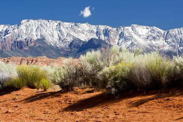
Where better to go for photos of our "Geo" than Nat-GEO? National Geographic has been and is still the premier magazine for photo essays about anything on the planet.

What you may not know is that photographers from all over the world submit photographs to them, hoping to jumpstart careers, get noticed, show off or just share a truly unique moment captured fortuitously. And they regularly make selected photos available for people to download as wallpapers.

Here is a selection of the best of the best of National Geographic desktop wallpapers, including some from the National Geographic photography team and some submitted by their site readers. The photographers’ comments are also included here.

Tuesday, December 25, 2012

A Good Year For RZR 900's - Scanlon Ferry Road

Being very unhappy with the way his last rig was designed and thereby performed, Gordon determined to buy the new RZR 900 this year – and he did. Apparently, at the same time, Hugh became enamored with the machine and replaced his old rock-climber as well.

Arriving at their favorite riding spot for the winter season (Beaver Dam/Mesquite Nevada), they found that Steve had also made the same decision. Hugh and Gordon took their rigs on a "shake-down" ride up to East Canyon (which we already told you about) and then all three of them went down to Scanlon Ferry road – to test out their brakes!

They wrote that the trip, which normally takes merely a full day's ride, became a tad eventful – well I'll let Hugh tell you about it…

"Steve, Gordon and I went for a ride yesterday (Dec. 20th, 2012). We all have 900's and it was Steve's first trip out with his.

Thursday, December 20, 2012

East Pass - "Officially" Closed

It's one thing to have the BLM put up a sign and close a trail; but, quite another still to have God do it. One of Hugh's - and I suppose mine as well - favorite rides from the Mesquite Nevada area is to run up Beaver Dam Wash, through the Tule Desert past Sam's Camp and over what people call East Pass back into Nevada.

Well he and Gordon just attempted their annual ride and he's just sent in a report that "As of Dec. 17, 2012 East Pass is now officially closed. See attached pictures for documentation."

I've posted a previous article and map of the East Pass route. Thanks for the photos Hugh.

Thursday, November 22, 2012

101 Places To Go Things To See In Utah

Washington (Utah) Morning '11

This is a post about what to do and where to go that is interesting in Utah. It didn't start out that way. I was actually looking for some information about deserts.

I peeked into a site called Desert USA and stumbled upon several lists of places to go – things to see in the desert countries and realized there were a lot of those things in Utah (and the surrounding states of the west); and many of them I have seen.

Actually there were lists of things in a lot of states but, for now, I just limited my search to Utah and found 101 of 'em! (That is if I count correctly)

For your holiday perusal I've sort of cleaned up the list, categorized them a bit and added some links. See how many you've been to and I'm sure you'll add a few to your to-do lists.

Can you add any others to the list? If so, add them in the comment section below.

Wednesday, November 7, 2012

GEO-tography: Moon

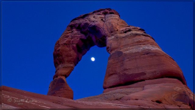
It's that time of year again when, thanks to our wonderful congress, we get to see the moon rise when we are driving home from work. In fact, depending upon where you live, the dang thing may have already been out for hours.

That got me to thinkin'. I've never done a GEOtography post about the moon. The thing is, for photographers, it's a difficult shot. And once you get all the camera setting down pat, the kind of photographs you can take are a bit limited.

However, the photos you can take come out quite stunning. One does quickly discover however that its just as much about what else is in the photo as it is the moon. In fact that's what gives variety of these things and sets your shot apart from those everyone else has already taken.

Tuesday, October 23, 2012

GEO-tography: Halloween 2 - Ghosts

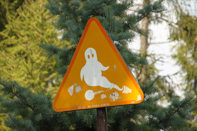
Beware of the Ghost sign
It has almost become a tradition to do a Halloween post here on Offroading Home. We haven't done much riding this summer, and the posts have gotten a tad sparse, but we cannot go against tradition and disappoint Tevia. For, without tradition, what are we?

You remember that last year we highlighted photos relating to "Devil" of some sort: Devil's Cove, Devil Mountain, Devil's Fire – and so forth. This year we simply turn to Flicker and are inundated with photos relating to: "Ghost."

Not simply just Casper, but a whole host of photos documenting how often plants, trees, snakes, towns and ships are named after the specter.

We sorted through a thousand or so photos and selected the most interesting for your seasonal perusal – with preference given to those representing a location, geography, flora or fauna.

Clicking on the photo will take you to the original photo where there often can be found a more complete description.

Sunday, September 30, 2012

GEO-tography: Manipulations

I ran across a professional photographer and retoucher from Sweden named Erik Johansson in my surfing of the web the other day. The guy has an amazing talent for producing incredibly realistic and creative photo manipulations.

Of course he uses Photoshop, or some such photo editing program, but he starts with real photos then massages their little 'pixels' into some quirk of his bizarre imagination that surprises, if not outright stuns, an unsuspecting viewer.

Now, I know that they don't all have a direct relation to the "Geo" which is what these posts are all about; but, once you see them I think you'll agree that it's just too tough to break up the set.

Sunday, June 17, 2012

Utah Arapeen Tail System Map Update

It's one of the reasons that the economies of the small central Utah towns are still solvent – the extensive offroad trail system that they have learned to promote.

The Utah Arapeen Trail System is in the Manti-LaSal forest and the city fathers of the many little towns (with a bunch of coaxing from both local businesses as well as offroaders) have come to learn just what a valuable asset the trails in the surrounding hills are to their local economy.

Anyone traveling in central and southern Utah will quickly come to realize that the towns are all spaced a day's journey by horse and wagon apart, a legacy of simpler times.

All of the towns have local ordinances which welcome offroad vehicles to traverse their roads with almost none of the hysteria or inordinate rules that accompanied similar considerations in Mesquite a couple of years ago.

Wednesday, June 13, 2012

GEO-tography: Oceans

There is nothing quite like living next to, or near, an ocean. From the temperate temperatures, to the wild weather; from the (mostly) free swimming to the "magnetic" sand; from the great growing-seasons to the constantly limp and damp bed-sheets; from the… well, you get the picture.

The one thing they all have in common however, is: Grandeur – and terrific places to take pictures because of it; especially if you go a little off-road.

Just about every category of photo we've highlighted here in GEO-tography is amplified at least double near the ocean. The crags are craggier; the colors more vibrant, and more subdued; the clouds more widely varied; water more in-your-face; and the sunsets, well, let's just say that you've never seen one until you've seen one across the watery horizon.

Saturday, June 9, 2012

Offroad: Mormon Mesa-St. Thomas

This ride was a good days outing from Mesquite Nevada in a mini-van around the historic Mormon Mesa and St. Thomas overlook. The ride was 125 miles around some breath-taking overlooks and red rocks with a thousand feet change in altitude. At the time of the ride the dirt roads were dry and fairly well maintained. Lake Mead was still below the historic town of St. Thomas and hiking trails were being well used.

Seeing the Virgin River Valley from the top of Mormon Mesa with Gordon and Hugh wasn't enough for me. Even though they were dirt, the roads seem to look like they'd been scraped in the not to distant past so we decided to try to get the family van up the mesa from the Overton side so Mom and Dad could see it too.   [A free Google Earth file of this route is available at: Google Earth Trail FileOffroading Home.]

Tuesday, June 5, 2012

Utah Wins Best State Website

Hey… I've got some news for you. As part of running a blog for the past five years, I've had to become fairly acquainted with the issues and techniques of web development. And, as such, find myself frequenting the blogs of "opinion leaders" in the area of web design and development.

One site that I visit fairly regularly is: Design Shack run by Josh Johnson, Joel Bankhead and David Appleyard. In addition to writing articles about how to blog effectively, they occasionally scour the web themselves and give ratings and rankings to sites they find in some particular category – and they are very well thought of.

One of their recent articles was a ranking of the websites run by each of the 50 U.S. states. Now these sites are government web sites, published by the state as their "official" presence on the web – not only to represent the state but to be the "gateway" for it's citizens to contact and obtain services from the state. Just take a guess which state won the very top honor.

Friday, June 1, 2012

Offroad: Five Canyons Trail

Forty-three miles and a full day will get you out of Mesquite and into the mountains for a great loop around the five major canyons in the Bunkerville Range of the Virgin Mountains; plus a picturesque valley thrown in for good measure.

This is a ride which can easily be done without trailering from Mesquite. It loops from Water Tower Lane in Bunkerville to North Valley before running into the Parashant via the 4,900 ft Lime Kiln Canyon and returning via White Rock Road. It also happens to be what we think is the very best get-acquainted "sampler" ride one can your visitors on.

Although there are roads and trails going up all the canyons which can be navigated by 4-WD vehicles, the trail as shown in the free map accompanying this post is best taken on ATVs, side-by-sides and single tracks due to width, camber and turns. None-the-less, it really is considered beginner level (well, one part is a "strong" beginner level due to incline). [A free Google Earth file of this route is available at: Google Earth Trail File Offroading Home.]

Monday, May 28, 2012

S California Offroad Map: Darwin Falls

The fifth in a series, a completely new trail system has been added to the Southern California Master Map file which is available for free at the Offroading Home web site: The Darwin Falls Offroad Riding Area.

The California Master Map having been split into North and South, room for more trails exist; although, the way things are going the southern map may need splitting again shortly. One hundred and twenty-eight new GPS locations for mines and other waypoints have been added to the Darwin Falls Trail.   [A free Google Earth file of this route is available at: Google Earth Trail FileOffroading Home: Southern California Master Map.]

On top of that, eighty-six new trail segments (both ride and hike) have been added … WHEW! These new additions have been submitted by an "anonymous reader" who apparently is some sort of "mine aficionado" scouring southern California for mines and their data. Credit where it is due to Mr. Anonymous; but, the data needs substantial re-working so I'll pat myself on the back as well… even if I need to dislocate my arm to do it.

Thursday, May 24, 2012

Offroad: Mesquite-Bunkerville Backroads

We've been riding the Mesquite offroad area now for, what, five years? And we've tried to figure out the easiest possibilities to get from the city to the trailheads without the need for trailering.

The absolute insane prices of gasoline in Mesquite the past couple of years makes this even more important; especially since careful price comparisons often make it more economical to drive up to St. George to fill up than at any of the local stations – even with the higher per gallon gas tax in Utah.

In years past we've run around the city on the back roads to show that it's possible to get from one side to the other – although the spiteful closure of the newly refurbished city creek wash makes it nearly impossible this year. And, we've run from the south up to both Flat Top Mesa and Whiterock Road.

Sunday, May 20, 2012

GEO-tography: Reflective

The magnificence of being outdoors is heightened by being "off the road." Offroader's prefer the destinations with a view and for many seniors the only way open to be able to see them is on an ATV or some like vehicle.

Today's collection of "Geo" related photography is about an aspect of the view which is not often noticed and in fact can be looked directly at but not seen. The human brain is funny that way.

I'm talking about: reflections. And, they are everywhere, not just in mirrors as the images below will reveal.

Friday, May 18, 2012

How Much Water Is On The Earth

"How much water is there?" is a question that I remember asking myself (and others) back when I was in high school. I didn't get a good answer then, and it seems that other pressing issues completely buried all memory of the event until this week when I found the answer from the USGS: How Much Water Is There Really?

Wednesday, May 16, 2012

Falling Man Update

In a bit of unusual happenstance, Gordon and I were taking one of our last rides together on the butte this season (and still commiserating about the complete incompetence of the BLM over the "first rock" fecal "grafitti" that they have been completely ignoring for the past two years on some of the most old and rare petroglyphs in the whole area) when we saw something completely unexpected that I'll tell you about.

But first, as you may know, there are petroglyphs of several different ages at this particular site and it's some of the oldest that are being destroyed by the fecal matter being flung at them. We've posted about this before in this blog and reported it to the ranger as well as other BLM officials more than once. My guess is that either they are so misguided that they think large birds can't fly to another rock to nest; OR they are too lazy to do the minimal work necessary to "rearrange" the birds descretionary choices.

PEOPLE, birds can move (even poor little eagles) but petroglyphs can't! And, once they're gone, they're gone… FOREVER!

However, I digress. You must forgive me, for this kind of "official" incompetance stirs my soul. Back to the story.

Thursday, May 10, 2012

S California Offroad Map: Blythe Vidal Riding Area

The latest in a whole series of updated to the California maps, an entire new trail system has been added to the Southern California Master Map file which is available for free at the Offroading Home web site: The Blythe Vidal Offroad Riding Area.

Tuesday, May 8, 2012

Offroad: Old Narrows Trail

The trail that once was: The Gold Butte Narrows. Oh… I know, those of us "Johnnie-come-lately's" still have a trail we call "the narrows," but as good as it is, it doesn't hold a candle to what "once was."

Back in the day before the National Park Service (NPS) got a burr in their blanket and decided to close off the well used trail, one could navigate up a high-walled, carriage-wide, multi-colored, serpentiginous, slick-rock canyon to everyone's amazement and absolute delight.

Today, pretty much NO-one uses it at all – except those who ignore signs.

Hikers don't – because it is really, really, really far off road from the nearest staging area, across huge amounts of uniforn, non-colorful, boring, hot and flat desert and would require them to ride an offroad vehicle to get there to hike it. And, because it was never really important to them anyway.

Sunday, May 6, 2012

S California Offroad Map: Alexander Hills Riding Area

Yet again, an entire new trail system has been added to the Southern California Master Map file available for free at the Offroading Home web site: The Alexander Hills Offroad Riding Area.

Friday, May 4, 2012

Offroad: Red Hollow Arch Trails

This is a rather unique post in that it had its origins in an email with a question: "I'm an offroader who loves to travel in mountains with my group on our my bikes and am wondering if there is a 'best way' to get to Red Hollow Arch in southern Utah," or words real close to this.

He went on to say that he was able to see the place on Google Earth, and several trails – at least what looked like trails; but, wanted to begin in Beaver Dam and travel to the arch from Arizona. He wondered if any reader had been there and submitted a recent trail.

Well, I was glad to help; but, there was one problem: I personally had never heard of Red Hollow Arch so didn't have a clue where he was talking about!

Wednesday, May 2, 2012

S California Offroad Map: Skeleton Pass Riding Area

An entire new trail system has been added to the Southern California Master Map file available for free at the Offroading Home web site: The Skeleton Pass Offroad Riding Area.

Monday, April 30, 2012

GEO-tography: Forest

Without a doubt, most of the Utah offroad ATV trails run through our wonderful mountains. And, it just so happens that the most downloaded post of any we've ever done on Offroading Home is the GEO-tography post about mountain photos.

However, much of a mountains granduer has to do with its dressing: forests. It is true that often we don't stop to see the forest for all the trees, like these aspens near Old LaSal by Moab.

I ran across a photographer who had some great tips for us the next time we're out photographing trees. And from what he seems to say, it's not that difficult to obtain a great shot: "Take time, find a point of interest and shoot any season" – now those are things that I can do!

Take Time

"One of the beautiful things about landscape photography is that there is no need to hurry. Take your time and get a real feel for what it is you want to capture. Time is on your side. Lighting conditions can change dramatically throughout the day, and if you’re really fortunate, the perfect shot may find you!"

He say's for us to "wander through the forest and consider all the possible vantage points" which is something that most of us have down pat! Then he advises us to "try out both wide and telephoto lenses" or, I guess, to at least try zooming out and in if we have cameras without changeable lenses. Pointing a wide angle lens upward emphasizes size and scale. A telephoto lens compresses a row of tree trunks and captures patterns.

Saturday, April 28, 2012

S California Offroad Map: Whipple Mountain Trails

An entire new trail system has been added to the Southern California Master Map file available for free at the Offroading Home web site.

Wednesday, April 25, 2012

Offroad: Beaver Dam - East Pass Loop

I got a chance to take a ride in Gordon's CanAm and jumped at the opportunity. We joined Hugh and the "Beaver Dam Gang" on their adventure up "The Wash" to "however far we can get before the snow stops us" – not really expecting to get all the way to East Pass, which I think was Hugh's secret goal.

The Beaver Dam Bridge seems, to me at least, to have a new entrance this year after all the repairs to the bridge caused by last years floods. It actually makes it quite easy now for all the town's residents to head to the trails on their ATVs – a major past time activity for them.

There was but the tiniest trickle of water in Beaver Dam Wash this winter but you could tell that there had been major runoff by all the broken limbs and debris strewn along the banks and caught on rocks.

Monday, April 23, 2012

URGENT: Help Rescind Mesquite's Wilderness Bill

Tuesday, April 25th, the NEW Mesquite City Council will discuss a resolution to RESCIND former mayor Susan Holecheck's (now a paid lobbyist) resolution to close off the entirety of Gold Butte, clear up to the outskirts of Bunkerville, from offroad use and make it the largest wilderness area in the state.

All interested offroaders should attend the 5pm meeting as we have been told that Susan, Nancy and their Sierra Club type contingents intend on bussing people up from Vegas and stuffing the meeting at City Hall. Naturally, as is probably their intent, the latest battle is occuring after the large number of senior offroaders have left for the summer.

Thursday, April 19, 2012

Offroad: Anniversary-Oar Car Mines

For some reason this year, it has taken nearly everyone a lot longer to "ramp up" for the offroading season in Mesquite – the "oomph" just didn't come easy.

I thought it was just me, but all the locals I know are going through the same thing – a touch of the ol' "lakawanna." It could be the weather, it could be the "been there, done that" syndrome or it could be that pretty much every time we hear of Gold Butte or the Bunkerville Mountains any more it's in the context of some political idiocy.

The weather was cold when we arrived (unusual), got intermittently wet (not enough to do much good), snowed (not really unusual, but early) and completely warmed up (odd) – so perhaps that's it.

With the weather being so capricious, and gas prices being so unearthly high, we didn't want to trailer very far; so, I guess it might be a bit more difficult to get excited seeing the same things over again. However…

Tuesday, April 17, 2012

Southern California Desert Offroad Map: Anza Borrego

Now that the California ATV Master Map has been split into two parts, the Desert Offroad Riding Area is undergoing major additions.

Sunday, April 15, 2012

GEO-tography: Silhouette

Photography of the "Geo" is what these sessions are about: GEO-tography. We look at them because as long as we are on the off-road most of us are taking photos, and as long as we are taking photos we might as well at least TRY to do a good job.

Are we photographers who need to go off road to get good photographs? Probably not… oh, let's call a spade a spade– mostly not. We're offroaders who either: want to prove where we've been or merely need to be able to remember where we've been.

This session is about a topic which all of us mostly overlook and most of us always misspell: silhouette's. They're not all that difficult to obtain, and most of us have accidentally gotten them unintentionally– some more than once – yes, you know who I'm looking at!

Friday, April 13, 2012

California Trail Map - Split

The California Offroad Trails Master Map has been split into two parts: Northern California Trails and Southern California Trails.

Wednesday, April 11, 2012

Offroad: Carp-Caliente Loop

Literally the very first "offroad" trip we took when snowbirding into Mesquite for the first time five years ago, was the dirt road exiting I-15 toward Carp-Caliente. We were in a touring car, which wasn't so bad, but noticed that we were at around a quarter-tank of gas, running through some pretty isolated country.

Couple that with the fact that there are absolutely no route or place signs out there, AND it was before I had bought my first GPS unit, and what it meant was that, although we knew Carp was up here somewhere, we had no idea how far it was from where we were or even where precisely WE were.

We turned around long long before seeing what we expected might be something called Carp, let alone Elgin; but, we did make it back before running out of gas. So, every time we have passed that exit since then, we had a nagging sense of failing to find out what was up there.

So, after the trip into the Tule Desert this year on ATVs, and having a much better understanding of the relationships between places, we decided to see how far the van would get us up that road.

Although, as Murphy seems to have decreed: because there have been so many waypoints plotted on my GPS that I have begun to "archive" them, yet again this year I STILL hadn't brought any of the landmarks for the area! Couple that with the fact that there STILL aren't any place signs for most of the area's historic places and it means that we STILL haven't seen Carp!!   [A free Google Earth file of this route is available at: Google Earth Trail FileOffroading Home: 05-Carp-Caliente.]

Saturday, April 7, 2012

Offroad: Black Warrior Mine

It's a rare opportunity when Gordon will offer to give up his new pup's "sidekick-seat" to someone, so when it happens you take him up on it. He, dad and I wanted to take a "quick" ride somewhere shortly after Christmas and we ended up heading north up the good ol' highway 91 from Beaver Dam Arizona.

Gordon had ridden the area above Lytle Ranch Road a few weeks before with Hugh and wanted to show us the general area where they went. With plenty of time and no real plans, we stopped at the mouth of the canyon to see the caves that always looked interesting enough to wonder about but not enough to have stopped.

This time we stopped and found… pretty much nothing much. They must have been something at some time but it's probably anyone's guess as to what, this late in the game.

Tuesday, April 3, 2012

Offroad: Quick Trip to Lime Kiln Pass

The winter of 2011 is a funny snowbird year weather wise. Snow came and then … went. Just after Christmas it had warmed up and the snow had all but gone from the mountains.

We decided to get out of the house and take a quick afternoon ride up to the "fish tank" – the name the locals have given to the huge stock tank at the mouth of Lime Kiln Canyon which everyone has taken on as a project to keep stocked with goldfish. (I've written about that before).

Saturday, March 31, 2012

Offroad: Toquop Gap

Charlie and I needed some space to clear our heads in the fall but haden't quite gotten our "oomph" levels up to where loading and unloading and trailering our ATVs interested us yet.

So, where to ride when you're completely surrounded by dirt, if you can get to it? Most everywhere close we've already been to many times. Where could we go that we didn't need to trailer, we wouldn't mind seeing again and we would stand a high probablility of seeing something we hadn't seen before?

For us, this season, it was up into the Tule Desert (pronounced too-lee). Yes, if we weren't going to trailer we needed to start the ride with the standard (and at least comparitively speaking: "tiresome") ride up and over Flat Top Mesa, and yes, we then had the "long and arduous" washbords of Toquop Wash; but this is offroading we're talking about!

Tuesday, March 27, 2012

Offroad: GB Mines

The last time Charlie and I trailered down to Gold Butte (the town) we decided that it was easier to ride our ATVs down than pull a trailer, so we wouldn't do it again. However, the allure of being able to ride in air-conditioned comfort down a road you've already been on plenteous number of times before, makes one reconsider past decisions when conditions change.

Such was today. Gordon brought his much more rugged frame trailer and we wanted to test to see if it would ride better than the fairly massive toy-hauler did before. The findings: 1) it did ride better, 2) the road was no better than before, and 3) it still is easier to take the ATVs.

However, the break in the weather gave us a chance for a 'shake-down cruise' to loosen up the shock absorbers, limber up the springs and see what surprises, if any, 'the Butte' and the BLM had left for us over the summer.   [A free Google Earth file of this route is available at: Google Earth Trail FileOffroading Home: 02-Gold Butte Mines.]

Friday, March 23, 2012

GEO-tography: Dirt Roads (mostly)

Roads - it's what Offroading Home is all about. Whether it's being ON them or OFF them all together in an ORV. The lure of going somewhere to see something often puts our mind on something other than the road; but, it's there none-the-less.

On the other hand, sometimes for us off-roaders it's the road which is uppermost in your mind, whether it is in the high-uintas or looking down the Scanlon Ferry Road and wondering if you're going to ever going to be able to get back out. But, surely (excepting New Yorkers) it's a rare human these days who hasn't trodden at least one dirt road.

So, here is a collection of photographs of some of the world’s dirt roads just to show you how universal a dirt road is and how they can be used to add interest and perspective to the photographs we take.

Thursday, March 22, 2012

Utah's Got It Right: Public Land Bill

I've just recieved word that the Governor of Utah will Sign the Public Land Bill tomorrow. It's being called A modern day declaration of independence designed to stop and prevent Obama's government from any more "land grabs."

Gold Butte: Bloom Alert

The spring wildflower bloom on Gold Butte is within hours of being upon us. On a ride taken to the (former) Treasure Hawk Mine on 21 Mar 2012 we noticed that a few specimins were fully open but thousands more were budded and ready to burst any minute. The whole of "Pleasant Valley" (valley with the old generator to the south of Gold Butte (the town) should be ablaze next week. However, it doesn't look like…

Sunday, March 18, 2012

Offroad: Virgin River

Nine hundred and ninety nine times out of a thousand the Virgin River is pretty much as laid back a river as you'll ever want to meet. Always a refreshing and beautiful landscape, it was once a terrible hardship to pioneer travelers; but, today, merely an annoyance preventing one from crossing anywhere one wants and a source for mosquito's and Tamarisk.

However, its increasing schizophrenia has been bringing it to people's mind a bit more often lately; namely, the thing has had two 500-year floods in the past five years! The restorationists have had a couple substantial setbacks of late when huge volumes of water tried to see just how high up the banks it could erase in one fell swoop.

We were greeted to the 2011-12 snowbird season, yet again this year, with a couple of weeks of rain. Nowhere near the deluge we had last year, but enough to prevent much escaping from the condo.

Wednesday, March 14, 2012

Offroad: Five Canyon Loop Trail

When one has been riding the off-roads of an area for several months one gets a bit nostalgic when it is time for one to migrate once again back up north. Such is the case with this ride taken at the end of the 2011 riding season (sorry, I just noticed that one or two rides hadn't been posted yet) around the "Five Canyon (or maybe six) Loop".

The 2011 offroad riding season in Mesquite Nevada was an odd one by almost any standards. It rained more water and longer than any of the four previous "snowbird" years so we almost spent more time indoors than on ATVs in the desert.

It warmed up later in the season and we were still riding with jackets through March when we took this loop ride around nearly all of the canyons in the Bunkerville Ridge south of Bunkerville. There were at least five or maybe six if you count Hen Springs Canyon.   [A free Google Earth file of this route is available at: Google Earth Trail FileOffroading Home.]

Saturday, March 10, 2012

Offroad: Parashant - Savannic Mine-Tassi Springs Loop

I just noticed that in all the frenetic hustle to pick up stakes and migrate, there were two trails from last riding season which didn't get posted. Nor did their accompanying maps. We have been there before but this time Gordon and I were able to convince dad to ride with us down into "the Parashant".

Monday, March 5, 2012

Keep Offroading Home Alive and Free

As annoying as it is, daylight savings is soon upon us which, to Offroading Home at least, means that it's time to think of paying server costs again to keep the web, blog , forum and free offroad maps online.

It's not much when compared to the national debt, the price of gas or new tires, but all my donated time doesn't pay the web-server costs for a site giving out free off-road maps.

So, a great big thanks to the Mesquite Kokopelli ATV club, Lindley Construction and to all of you who have spread the word about our site and helped with costs this past year … we need it again
.

Open The Money Jail

There is an area where we need some extra help. I've mentioned before about the "money jail" Amazon and Paypal (and others) create by limiting payouts to a certain threshold amount. That means even though someone donated money months ago - we still don't recieve it until the total amount exceeds $100.

I have to say that even with the generous donation from the club again this year, we're still about $100 short and a big hunk of that is tied up in "Money Jail." A couple small donations will let the captive funds go free and keep us from closing down.

I'm much more versed in things like scouting and verifying trails, GEO-coding waypoints and tracks, digitizing map coordinates and programming Google Earth files than I am in raising funds. So, I look to the web for help.

Last year I ran across a guy who said that whenever he needed funding he just put up his photo with a direct approach asking for money. Of course I didn't think to ask if he ever got any.

So I did the same thing - I put up his picture asking for money.

Show Support


It worked, but not like he said it would.

So, this year I'm thinking that I'll appeal to a broader range of sensibilities, like:

Perhaps, cat lovers…

Cat Lovers
Support The Effort


- and not to be out done, I need to think about dog lovers too…


Dog Lovers
Love The Offroad


And just to cover all my bases…

How about helping one of these cute little kids out?


At any rate, I hope you get the picture… Offroadinghome, just about the only offroading site which still offers free off-road maps to support the hobby, needs your donation to stay "on the air" and keep the maps free. I hope you can, one way or the other.


Thursday, March 1, 2012

Offroad: Mormon Mesa Point

In order to explore the Mormon Mesa a little more, Gordon, Hugh and I took to the offroad once again and headed south. OK… Gordon had convinced Hugh to go find two mines which were on his mine database, but which no one in recent history had seen. Then somehow we ended up on the trail without the coordinates to the spots so went sight-seeing instead. And I'm glad we did.

The view from the top gives the Grand Canyon and Bryce Canyon a run for their money; but, I digress. Hugh calls any trailhead in the area, except the water tower, "riding from the girls trailhead." So, once again, we staged at the water tower parking area on Ben Franklin to begin the days ride.

Up and over the Flat Top Mesa is a beautiful ride, in and of itself; but, for me at least, I've already "got the tee-shirt" on that ride so it can be a bit of an impediment to getting to the "real" destination on the other side. Recent weathering and wear has made opening and closing the gates at the top on the steep grade quite an adventure; so, if you're smart you'll make a side-by-side carrying two people go first. The "spare" can climb over to the gate and open it to let everyone through then close it after.

Wednesday, February 22, 2012

GEO-tography: Deserts


In the past I have showcased examples of landscape photography, which has included photos of mountains, valleys, plains, lakes, coast lines, and a variety of other types of landscapes. That's what I'm calling GEO-tography – photography of the "GEO."

I guess it depends upon where you do your riding as to what pops into your mind when someone says: "landscape"; but, around here it's pretty much desert. I admit that sometimes it hard to actually see the desert for all the sand, especially when you are washing it out of your hair and shaking it out of pretty much every bodily orifice.

Friday, February 17, 2012

Offroad: Parashant - Grand Gultch Mine

I have written about offroad rides to the Grand Gulch area a few times previously: Offroad: Savanic, Offroad: Mine Hunt and Offroad: Tassi Springs. Here is a submitted trail which can test all of the bolts and nuts in your rig – especially the one behind the wheel.

Gordon got a new Can-Am so he and Hugh decided to give it a test run up to one of their favorite locations: Grand Gulch Mine, down there in the Parashant wilderness. The Parashant arm of the Grand Canyon is to the southeast of the Virgin Mountains from Mesquite Nevada. The Grand Gulch Mine is on the bench between Grand Gulch Canyon and North Fork Canyon in western Mohave County, Arizona.

Their ride, taken in late winter from Whitney Junction, turned out to be a 96-mile (round trip) to the mine and back over the same route. It was cool late winter and, of course, taken in their side-by-side UTVs. Even so, they rate the trail very difficult due, in large part, to the portion beyond the Savannic Mine – i.e. over the top to the Grand Gulch.

Sunday, February 12, 2012

Extreme Sleepovers

Everest Base Camp, Nepal (Credit: Andrew Murray)While researching for an unrelated post I stumbled upon an article which had me mesmerized enough to journey on a major diversion of such proportion that I still can't remember what it was that I was originally looking for.

The great gimmick these days seems to be trying to set yourself apart and garner attention by calling whatever you are doing an "extreme" something. "Extreme Makeover," "Extreme Sports," … "Extreme Politics," "Extreme Tree Hugging." You get the idea.

So I was a little taken back to see the title: "Extreme Sleepovers" – sorta sounds like something your teenage son is begging for you to authorize over spring break. It turns out however, that if anything has the real right to call itself "Extreme" anything it's this: doing research on Mt. Everest.

Tuesday, February 7, 2012

Mesquite-Overton Loop Trail

Pretty much a yearly tradition for the Mesquite Kokopelli ATV Club last Saturday's ride welcomed a hefty number of new members, almost doubling the size of the club this year and took the backroads over to Overton along the Mormon Mesa.

From the water tank trailhead, (the large gravel parking lot at the top of Ben Franklin Drive), the trail began first to go up and over Flat Top Mesa, a very scenic ride in itself. Once on the other side in Toquop Wash the trail to Overton begins just on the other side of the I-15 bridge and heads west beginning the climb upwards.

The first goal is to run along the Virgin River over to and cross the Riverside Road at Cook Bottom. The twenty-two rigs made it easily across the highway in shifts as there is rarely any traffic on the highway.

Hugh blazed the way following the Virgin River along power-line roads and offroad trails for about 7 miles (17.5 mi from the trailhead) until one last "up and over" brought the group down into Half-way Wash.

Thursday, February 2, 2012

GEO-tography: Birds

Most of us old codgers spend more time sittin' on our offroad bikes than ridin' on 'em compared to "young bucks" who wanna' just get there! After a few miles of bouncing around on an ATV or JEEP, it's a welcome relief to disembark and sit a spell.

Besides, that's when you see things and hear things. Only the very naive think they can see the sights in a moving vehicle – what, merely wave as you pass by the Grand Canyon? It is true that compared to what many kids listen to today, an ATVs engine is probably barely noticable; but, not for a chipmunk or a bird! If you're wondering why you never see any wildlife on your rides it's probably because of the direction you have your key turned.

You don't want to have to reply "the handlebars" when you get home and are asked "what did you see today?" If for no other reason than the fact that it makes it easier to convince your wife to let you invest in next season's model of bike - you need to bring back some pictures! Some intrepid souls even learn to like taking them and then even become quite good at it.

That's the point of these collections that I call "GEO-tography." Photos of the "GEO" that you and I see in our offroad forays. And, you really know that you are getting the hang of it when you can capture one of those flighty birds on film (or memory chips as the case may be).