Tuesday, December 27, 2011

GEO-tography: Paths and Trails

While we are spending a boatload of time trying to upgrade the blog to a new format, we could let you see a few more inspirational examples of offroading photography – what we call GEOtography. We call them inspirational because that is what we are attempting to do – become "inspired" with how to make our OWN photographs just a little less blurry, more in frame and possibly something that we can show to people outside our own family (who have to like our pictures).

Today we'll look at paths and trails and ways of getting somewhere in the landscape. Dorothy had her "yellow brick road" to follow, others a "road less traveled" but there probably isn't one of us off-roaders who haven't said "I wonder where that road goes?"

My guess is that I'm not the only one on the trails who, when confronted with a fork in the road, feels compelled to find out where it goes – or, at least set a waypoint so we can see where it is on Google Earth!

Wednesday, November 30, 2011

Thank You - Whoever You Are

Thank you, Thank you, Thank you - whoever you were who got our Offroading Home funds out of "money jail." You know, that neat little scam that nearly everyone is doing now to fatten their coffers by forcibly "borrowing" money from us through the "rules" they inflict on customers for the "privilege" of merely doing business with them.

For years now, ORH has been linking directly to books and other things which we mention in posts. It makes it easy for readers to see what we are talking about; and Amazon, bless 'em, will give a small "finders fee" to us whenever you click on the link and decide to purchase the book… except, there is a small catch.

Monday, July 11, 2011

Ultimate Offroad: Terminus Overtakes Space Shuttle

Clearly the most iconic image of space for most of us is the "Pale Blue Dot" taken by the Appolo astronauts back sixty's or so. The beautiful blue earth in its entirety poised in its rightful place against the beek black vacuum of space. The photo has been "updated" several times by subsequent spacecraft; but, none hold the relevance to an entire generations' neural pathways as does the original which we saw taken live in the wee hours of the morning.

Many other space related icons clutter the minds now of the "internet generation" not the least of which is the ubiquitous "Google Earth" planet with its day and night terminus marching across the globe. "Terminus," now that's a word that none but scientists knew until Google. The demarcation on a map or globe representing the current position of the sun's shadow – the end of daylight… the beginning of the dark… the night.

Monday, July 4, 2011

Does that star-spangled banner yet wave o'er the land of the free and the home of the brave?


…Blest with victory and peace, may the heav'n rescued land
Praise the Power that hath made and preserved us a nation!

Thursday, June 30, 2011

GEO-tography: Macro

If it's one thing that senior ATV riders have along offroad trails, it's the proclivity to stop and take a picture of things we see and want to remember or show those back home. I call it: Geo-tography – photography of our "geo." Not that any of us have any grandiose ideas that we're going to become famous photographers or anything; but, just capable enough so that our digital cameras weren't a total waste of money.

The way I figure it, if I just keep looking at good pictures for long enough some of it may rub off on me – even if it has to be sub-consciously. So, when I saw a group of photos using the "Macro Technique" I thought that they might could use a closer look.

Macro photography is all about capturing things up close, usually involving special lenses designed specifically for this task. However, I notice that most new digital cameras come with some sort of "macro" setting, although usually require some actual reading of the instructions in order to find it.

Sunday, June 26, 2011

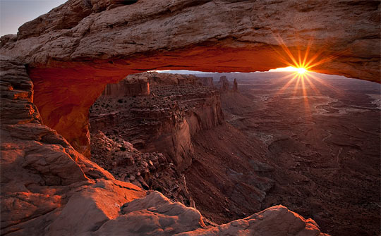
GEO-tography: Sunrise

Sadly, the most beautiful part of the day occurs before many people wake up, but thank goodness there are those early rising photographers or most of us wouldn't even know what it looked like. Those intrepid souls are willing to set the alarm clock a bit early in order to get their traveling over with in order to be in actual position to capture the beauty of a sunrise so others can see.

They may have either ridden their ATV's offroad in the dark or (heaven's forbid) actually slept on the ground in order to have their finger poised over the shutter button as the first ray of light proclaimed the advent of the promised new day.

Offroading Break

The call of the off-road beckons as a siren from the south, so a short break with our ATVs is in order. Until next week enjoy a couple of posts of GEO-tography.

Thursday, June 23, 2011

Jumbo and Lime Wilderness BLM Meetings

Never willing to leave well enough alone, the BLM wants to do a face-to-face with the offroaders around the Gold Butte area - and any who ever seek to go there.   [Previous post with wilderness map: Jumbo Wilderness-Pierson Gap.]

Ostensibly they want to hear your opinion about the two existing wilderness areas already on Gold Butte; however, we know all too well the agenda's and modus operandi of the Las Vegas office. They are actually mandated by law to hold "scoping" meetings, even though absolutely nothing (which can't be rationalized away) needs to be listened to or followed.

What must happen, however, is large numbers of off-road riders show up at: Bunkerville Community Center June 27, 2011 6 PM, Overton Community Center June 28, 2011 6 PM and Mesquite City Hall June 29, 2011 6 PM to demand answers to substantial questions in front of the press. And somebody should make certain that the local press attends.

Yea, I know that the two areas are ALREADY wilderness areas and that nothing short of a massive legislative recall and congressional Un-"wilderness-izing" the area can be done about it; but, these scoping meetings are the place to try and "entice" (or shame) the managing agency (in this case the BLM) into making implementation rules less prejudicial to the senior community and onerous to offroaders.

The backcountry rambler over at the "Save Gold Butte" blog thinks people should talk about "weed treatment for invasive species and developing interpretive information to educate the visiting public about the resources and history in the area." Those topics are, indeed, within the realms of the wilderness guidelines and I'm not saying they shouldn't be addressed. Although, I don't know which "visiting public" he has in mind – there is no visiting public… this is wilderness. Unless you count an infinitesimally small number of hikers.

However, the press will be there and, IMHO, at least someone should voice the intense disdain over the arrogance and incompetence of the implementers (read Harry Reid and his either incompetent or deceptive staff) who exhibited such obvious discrimination against the senior population which for years frequented the area.

What someone needs to demand is an answer why the boundary of the Jumbo Wilderness was drawn a matter of yards too far to the east to allow continued access to Cottonwood Canyon through the Pierson Gap trail! The final tiny section of the trail, runs almost parallel to the border between two very popular and still open riding areas, through rock and has been used for hundreds of years.

By precedent, a right-of-way for the existing historic trail should have been accounted for like has been done in countless other wilderness designations around the country. I'd also like to know what procedural or legislative method there is to re-align the border so as to provide multi-use through that minuscule portion of the existing trail. Or, in the interim, what alternative route can circumnavigate the closed portion.

Doing this in the off riding season, the time when there are least numbers of senior users in town to defend themselves, (which by the way is another question to demand an answer for) – what a deceptive, behind-the-back time to choose for your "scoping meeting" Ms. Marr – for shame!

Monday, June 20, 2011

Offroad: Mesquite - CCC Cabins

A bit stir-crazy from all the rain and snow, Gordon and I took our rigs up to Toquop Wash for the first time this season. There are many nice things to see up the wash, and several areas which are quite challanging; but, as rides go, much of is a bit nondescript so sort of falls down the priority list a bit.

Beginning up at the water-tank road trailhead, will take you to Toquop by a trip up and over Flat Top Mesa. You'll need to negotiate opening and closing heavy gates on an incline on both sides of the Mesa; so, unless the Mesa is an actual destination, most riders prefer a little easier access to the wash.

Thursday, June 16, 2011

GEO-tography: Spring

You know, if I don't soon post these photos that I've been saving about spring – it won't be spring any more. This year, we've got all the plants in but they haven't gotten out of their shock yet from all the snow and cold weather up here at summertime snowbird headquarters. By the time we take off our coats we will have missed spring entirely.

However, there must have been spring somewhere because look at all the examples of spring photography I have found. Our goal here is NOT so much become expert photographers BUT to get some ideas of how to make our own snapshots a bit more… let's say… "showable."

All of these, of course, are examples of what I call Geo-tograpy. They aren't always Geo-coded but are most always of our offroad Geo-graphy. As always, be a bit patient as they load because they are full photos. And if you've got some examples of spring geo-shots you'd like to share, post about them in the comments.

Wednesday, June 15, 2011

Obama Utah Land Grab

I have received information from USA-All that Obama is planning a "LAND GRAB" in Utah and the west similar to what Clinton did in his last ditch "scorched earth" method just before exiting the office.

The offroad group wrote: "Utah's Congressmen Bishop and Chaffetz and Senators Hatch and Lee jointly submitted a bill intended to prevent President Obama from creating HUGE national monuments in Utah. Last year Congressman Bishop uncovered internal BLM documents that appeared to show the Obama administration was considering an attempt to create 14 national monuments across the west including in Utah. Utah is still reeling from the politically motivated creation of a 1.9 million acre monument in the Escalante Grand Staircase by President Clinton in 1996."

The public lands group has begun trying to convince the delegation to opt Utah out in a similar fashion to what Wyoming did in the 1950's. I'm not sure what that fully means but if it will prevent Obama from pulling the atrocity that Clinton pulled – Offroading Home is all for it.

Saturday, June 11, 2011

Colorado Backroads: Offroad Trails Map Update

Actually, some time ago I spent what seemed like a year one month completely going through the Colorado Master Map and updating it to include the trails in the book "Colorado Backroads & 4-Wheel Drive Trails" by Charles A. Wells and published by FunTrecks.

The book contains descriptions for trails through colorado's most scenic areas so I was excited to see how they traversed the actual globe. I quickly began experiencing difficulties almost around every corner. Wells sometime used, lets say, "alternate" road and area names – at least different than I could find in any of the databases.

I could see that the book had only sparse GPS coordinates but most of the time with even just a few you can follow Google Earth satellite images along the trails – not to be. Colorado is covered in snow much of the year and a canopy of green the rest of the time so trying to follow trails from the outer atmosphere is maddening.

So, even though it was updated months ago, and I decided to go ahead and publish what I could to the server; I, none-the-less realized people would need some explanation about the different format these trails required and planned a blog post. Which post, I'm sad to say, got delayed… until now.

Tuesday, June 7, 2011

Offroad: Gold Butte - Devil's Cove, Horse Springs

The 2011 winter offroad riding season in southeastern Nevada, well at least the Mesquite area, has been an unusually - read frustratingly - wet time especially for all our ATVs held hostage under tarps and in garages. Don't get me wrong, we're happy for the all the citizen locals who are out dancing in the street for the dust-quenching moisture. Just sayin' …

Gordon and I braved the dark clouds in the morning, perhaps believing that: "if you go it will stop" or some such erudite sapience, and saddled up the CanAm and Yamaha to head for "The Butte." After all, one needs to ride it as often as one can before the Reid/Holecheck coalition closes it all off to seniors.

Friday, June 3, 2011

NEW: Bryce Canyon Trail System

You know, with age, I find it increasingly difficult to do two things at once. I learned a term in my youth, back when things called computers were invented – it's called "time sharing." Afterwards, the womens movement claimed the prior discovery rights to the activity; they said it had been inherent in the gender to "multi-task" since the time of Eve.

I used to be able to do it like a whiz, you know: drive and read a map, listen on the phone and continue reading mail, dictate a letter and drive to work, walk and chew gum… I used to be able to juggle navigating an ATV over a single-track, watching a GPS trac, scanning for photo ops, listening to a CD and pointing out items of interest to companions all at one time. Well, I still can do the "gum" thing but it's difficult to both work on building trail maps and write blogs at the same time.

However, have I got a deal for you today! A rider from southern California named Randy began communicating with me several months ago about some rides he had taken up in Utah, around the Bryce Canyon area. Over the last three or four months, we've been communicating about the area and he has been able to send in three great GPS tracks for those of you who want to ride the area with your offroad machines.

Wednesday, June 1, 2011

Salazar Backtracks On His Land Grab - For Now

Offroading Home has just received word Wednesday morning that Secretary Salazar will back off on his "Wild Land" grab … at least for now. The letter we received from USA-ALL is included after the jump.

Tuesday, May 31, 2011

Life's A Musical - Only In New York

What do YOU know about New York? Have you visited? Have you lived there? I have! What do you think of when a friend tells you that they met someone from New York? A pleasant, happy go lucky individual who will go out of his way to help?

It's true that most consider New Yorkers as a bit stand-offish, and I can tell you that, for the most part, it's earned. After all, you don't hear the challange: "got a problem with that?" said very often anywhere else in the world – unless maybe France. But, there is Central Park, and Macy's and Gimbal's and about the highest concentration of difference-tolerant carbon-based organisms found anywhere in the galaxy!

I mean, there was a reason that the "Men In Black" story could only have its setting in New York – it's the only place in the world where the story would be believable! I mean, alien creatures living completely unnoticed amongst the population? Really… they were aliens not wizards like in England.

So, what would happen in, let's say, Salt Lake or Mesquite, if you were in a food court and literally everyone except you broke into a chorus of Handel's Messiah? Or, broke into an opera about passing them a napkin? … Would YOU simply fake it and join in so you weren't the only one left out?

Wednesday, May 18, 2011

Godspeed Endeavour

Finally, after several delays, the spaceship Endeavour left the Cape Canaveral starting blocks for its final voyage to the International Space Station. Its 16 day journey to outfit the Space Station with the long awaited Alpha Magnetic Spectrometer began with a lunge toward the clouds upon the command of the Auto-sequencer which controlled the thousands of "double-checks" and switch-throws necessary during the last nine minutes before the sparks started flying.

The six lucky astronauts' families watched from the roof of the launch control center as the clouds swallowed the ship mere moments after the launch, leaving them stunned silent from the site. Congresswoman Gifford (the commander's wife) made her second trip to the cape from her rehab hospital stay in order to participate in the event and said "Good stuff… good stuff" as her husband flew toward the stars.

Saturday, May 14, 2011

Offroad: Gold Butte - Jumbo Creek Mine

It's plain to see why the "old-timers" decided to put in so much effort exploring around the Jumbo Creek Mine area. Quartz has always been known as a harbinger of precious metals because the same geologic forces which produce them produce quartz as well. And there's a lot of it, at least on one outcropping.

We've been there several times but we've never been able to find any thing left of the once "Jumbo Creek Mine" besides the white post in the middle of a quartz tailing's pile so attesting to its name. No mine entrance. No left over mine equipment. Nothing!   [A free Google Earth file of this route is available at: Google Earth Trail FileOffroading Home.]

In fact, there is no mention of it on either our GPS maps, our topo or other paper maps or even the official USGS "US Features" file which lists every registered landmark and geological feature in the CONUS. To make the enigma a bit more of a mystery, we stumbled across several BLM "mine-type" officials on our way down the Gold Butte Backcountry Byway who had come to The Butte to blow up some dangerous old mine entrances.

Monday, May 9, 2011

The Wilderness of Gold Butte

For some time now I have had the BLMs map of their proposal for turning Gold Butte (and Bunkerville Flats) into a WILDERNESS AREA, glaring at me from the middle of my desk top, not knowing what else to do with it except look at it and shake my head in disgust.

Frankly, as a useable map for making an assessment leading to meaningful comment, it is completely worthless; there, I said it. It is nothing more than an enhanced clone of the map the Las Vegas BLM field office foisted on us when they went through and systematically closed close to fifty or so trail segments a couple of years ago. That map was completely worthless to the public, and so is this.

Absolutely NO geo-location marks! Absolutely no latitude or longitude markings! No road names. For the most part NO readable, meaningful labels! All this leaving even the most basic understanding of where things are, woefully complex and time consuming; beyond what most reasonable people are either able or willing to undertake. Then there's obsessive-compulsive me.

Thursday, May 5, 2011

Offroad: Mesquite - Noodling on North Flats

Probably one of the easiest ATV, SUV trailheads to get to in Mesquite is up the Mesquite Heights Road, most know it as the "road to the dump." There is quite a large staging area for the trailers of offroad vehicles just to the left before you arrive at the land-fill, a testament to its popularity and frequency of use.

Most of the use is from all forms of carry-alls of motorcycle's. The sandy wash banks and trails make for favored two-wheeled riding and we have never failed to see a group of cyclists whenever we have been there ourselves. This day was no exception, there were five in a "sleeper-van" who were spending the day offroad down from St. George. Actually, they were back at their trailer taking a "break" when we arrived.

It had been one of the ubiquitous rainy days this season and quite chilly; when, the sun coming out of the clouds triggered one of our genetic responses to "swim upstream" and get out in the air. Late in the day, there is really only one place to go offroad from Mesquite and that's North Flats.

Sunday, May 1, 2011

Google Earth: Present and Future Tense

All indications are that Google Earth is about due for another Richter 7.0 shake-up – at least if you can believe the scuttlebutt at "Where 2.0" last week. I wasn't there myself, but lurkers in the "blogosphere" sure are all a-buzz about it.

"Where" is the massive conference started by Google last year to showcase their product and draw "groupies" from all around the globe who want to learn about and show off and network their projects that they are developing – notably those that use Google Earth and Google Maps. Using their familiar nomenclature, this, the second "version," is 2.0.

Wednesday, April 27, 2011

Offroad: Parashant - Savannic Mine

Little did we know that this snowbird riding season the Parashant Grand Canyon area would be the most interesting rides we would take… several times. And we would go again in a heartbeat.

We've seen it on our maps, and we've always intended to "run over to Arizona and see the mines"; but, it's a long way over there from Whitney Pockets, our usual staging area of choice. Just to Tassi Springs, which we wrote about last year, and back takes a very full day. The Savannic Mine - and others - are farther than that.

However… there is only one other ride on "The Butte" which rivals it for sheer grandeur! The ride over through Pierson Gap and down into Cottonwood Wash looks over the "Hell's Kitchen" area and is Magnificent. The ride along the shelf road, past Pigeon Canyon, is truly breathtaking, in more ways than one.

Of course there's the "breathtaking" grandeur of a Kodak-worthy photograph which even Photoshop cannot improve; then, there's the strangling-tightness which slowly creeps into your chest and makes your heart race for anyone even the least vertiginously challenged!

Saturday, April 23, 2011

GEO-tography: Forced Perspective

In our continual quest to make the photographs we take look more like the places we've actually been, I thought we might take a peek at something called "Forced Perspective."

We all (at least those of us who haven't been living under a basket) have seen the technique at work; but, may not recognize the accurate name. Forced perspective is the technique Peter Jackson (I guess we have to call him "Sir Peter Jackson" now) uses to make his Hobbit's look realistically small next to Gandalf.

Basically, it's using your camera's settings to obtain the great depth of field and focus necessary; then, aligning two subjects precisely - one closer to the camera than the other. (huh?) Look, take one subject and put it closer to the camera. Then, align a second object further away from the camera so that it looks like what you want in the view finder. Then do what you need to bring them BOTH crisply into focus at once.

Objects can appear farther away, closer, larger or smaller than they actually are, and you don't need to use Photoshop or Gimp to do it. It just takes a little creativity with the placement of the subjects in the shot and the camera angle.

Still don't get it - well a picture is worth a thousand words. Twenty-eight of them to be exact.

Friday, April 15, 2011

Pinyon Nuts

As kids, much more so than now, we used to enjoy going "pine cone hunting" in the fall. Not every fall; because, as it turns out, the little fellows are a capricious lot – not un-similar to those Joshua Trees. They don't seed (or bloom) every year – and they pretty much keep their intentions and motivations close to the vest.

Once in awhile you might hear an old timer say out loud: "'S lookin' like it'll be a good yar fer pine nuts!" But just let those trees not produce a crop this year, and that same codger is just as likely as not to give you a disgusted look like: "you must be nuts" when you remind him about telling you that later on if it doesn't happen.

Of course, even though most call them "Pine Nuts," it's only the specific Pinyon Pine which produces the nuts we are talking about. As nutrition goes, they are full of it. No wonder they were the dietary staple of the Paiute tribe as well as most other Native American groups throughout the southwest.

Indigenous peoples ate them both raw and roasted, and they often made Pemmican by mixing ground pinyon nuts with animal fat to make a calorie rich, nourishing and easy to carry "trail mix."   [See other information and photos at: Offroading Home - Resources.]

Monday, April 11, 2011

Offroad: Gold Butte - Jumbo Mine, Historic Baylor

This was the fourth ride for the Kokopelli ATV club in the 2010-11 riding season. It seemed like there were more new faces each time we rode and that everyone was getting side-by-sides. Some who rode single rigs last year were trading them in for "double wide" and bringing their wives along.

And this ride was a great place to be. It finished a previous club ride around the lower Gold Butte-Treasure Hawk Mine area which was cut short, due to some mechanical failures that required a bit of towing – yet one more reason not to go alone out on "The Butte." Especially on such a seldom used trail as this.

Almost directly on the other side of the mountain from the historic town of Gold Butte (east), is the historic town site of Baylor. Now only a dusty wide spot in the trail, people once lived there while working the area's mines in. Who knows, for a vacation they might have gone to the "big city," Gold Butte, of a weekend.

Wednesday, April 6, 2011

GEO-tography: Infrared

Anyone who has spent any time at all watching television has undoubtedly seen examples of the use of infrared. "Night Scopes" are all the rage, the isles at Home Depot are decked with infrared heaters and many of your home security motion detectors are actually "detecting" infrared.

It's nothing more than a small portion of the electromagnetic spectrum of energy with wavelengths just a scosh longer than visible light. Human eyes can't see it but snakes (and Voldemort) can.

However, with a special lens, some cameras can photograph in that spectrum – and what a site it is! All you have to do in order to show up in an Infrared photograph is be warm blooded! (or have some kind of body heat). You put off heat – you show up, it's that simple. And the more you put off, the "whiter" you appear in the picture; the less, the darker.

Wednesday, March 30, 2011

Offroading Home: "Thanks"

Offroading Home has dodged another years worth of bullets and will be around into the next riding season. If it's not the nasties who think that the best way to return the unicorns to the fields and phoenix to the skies is to attack and malign senior offroaders who want to visit Gold Butte; it's the web hosting services who bait and switch to improve their bottom lines.

What many of you don't know is that last year at this time our long time web host, ATT, gave notice that it was "getting out of the web hosting business" – at least for us "low yield" accounts; and, it was only through the magnanimous altruism of the Kokopelli ATV club that our hundreds of maps weren't banished to the isolated recesses of computer back-up disks, never to frolic free on the Internet trails to your computer screens again.

It should be obvious that the thousands of trails on our hundreds of maps have taken almost as many hours of programming and editing and are NOT thrown together willy-nilly by computer programs as done on most other sites. Nor do we take user submitted trails and make money off them. So far, we have still been able to keep the maps and sites fully open and free.

Thursday, March 24, 2011

BLOOM ALERT: Spring on Gold Butte

Gordon wins the award for spotting this years first cactus bloom on the Butte and letting us know about it. The Joshua Trees usually begin to sprout their fragrant lilac-like fronds skyward about this time; but, the number and amount varies with – who knows. Four years ago there were blooms all over the area. The following two years… not so much. We've just made it through the wettest, coldest winter in four years around here, so we should be in for a great display! If you've never see the Joshua Trees in bloom – you ought to.

Tuesday, March 22, 2011

Offroad: Gold Butte - Middle Area for Seniors

Absolutely anyone who has been on Gold Butte more than once in the past three years will immediately recognize the devastating effect the "Great BLM Barricade Project of 2009" has had on Seniors ability to visit sites they have been to for years and years.

Add that to the "landscaping" and "corrals" the fiends of Gold Butte have inflicted on the area and people who have lived here for years can't even recognize the place even if they could get to it.

Even though the Great BLM Trail Closure decimated accessibility to seniors, this post describes a full day ride through the Middle Gold Butte riding area, full of great color and things to see (if you can hike)… and to remember (if you can't).   [A free Google Earth file of this route is available at: Middle Gold Butte For Seniors.]

Saturday, March 19, 2011

GEO-tography: Reflections

I'll bet not more than one in ten of us actually "see" the topic of this GEOtography post when we are out riding. We can be looking right at a magnificent reflection and still be completely oblivious to it's existence.

We probably see more of them, or at least are more aware of them when we are looking at photographs; but, up close and in person – not so much. Most of our brains have been trained to tune them out as distractions. Until, that is, we take the time to just "stand a spell" and take in the view. If we decide to "really" look at what we are seeing they pop into existence as if by magic!

These photographers have captured "Reflections" to the "umpth" degree! As I think you will soon agree.

Wednesday, March 16, 2011

Offroading Home: on Google Earth

Some years ago now Google gobbled up a small upstart company whith a good idea: Panoramio. It was a company which developed software that would allow people with pictures to share – professional and wannabe alike – to geocode their shots with latitude and longitude then upload them to their servers for others to see. Their idea? To cover the earth with photos of actual places to go beyond what you could get with a flat map.

Once the company had succeeded enough to make it obvious that this was a good idea, Google made a couple of developers very rich… and happy! They bought Panoramio and added it to the growing cadre of "add-ons" to their second "cash cow" product – Google Earth.

Offroading Home has been using the service for years – it's a good place to "hang" your trip photos for others to see and the background is the actual earth instead of a wall.

Saturday, March 12, 2011

Geo-tography: Time Exposure

In this series of posts about examples of "geo" related photography we are trying to get acquainted with some of the examples and techniques from the "pros" (either intentional or otherwise) which might give us ideas for our own photographs. Ideas which, perhaps, might subconsciously sink into our brain and down into our camera arm and make the photographs we take a bit more representative of where we've been – so we can show them to our friends too and not just our family (who have to endure us.)

A post or two back we took a look at some photos people had taken in the "dark" and used time exposures in order to just get enough light to make a photo show up. And you remember that it was really fairly easy. All you had to do was set your camera for a longer exposure and/or "open" the lens up (increase the aperture number) a little more. The big caveat was, and it was a BIG one, that you needed to use a tripod in order to prevent the "shakes" from blurring the picture.

Wednesday, March 9, 2011

BLM CLOSURE ALERT: Update (UPDATE)

Within minutes of posting our last post about the defective BLMs closure maps - Offroading Home received a copy of the response from "Chuck" Patterson about a reader's request for extension. His response and it's inadequacy is below:

Tuesday, March 8, 2011

BLM CLOSURE ALERT: Bear Lake TMP (Update)

Thanks to a vigilant reader who actually read a previous post and acted upon it - the BLM has released, on an individual basis, a Google Earth based map of the trails in the Bear Lake Travel Managment Plan under consideration for closure. A mere two weeks before final deadline for comment unless an extension is demanded and granted!

It's a victory, but a small one. I'm not sure how many of you recognized that the Pocatello BLM Field Office, under the direction of Dave Pacioretty [dpacioretty@blm.gov - (208)478-6340], has chosen to do their maps completely different than any other BLM field office has done in the past - and not in a good way! Charles (chuck) Patterson, the Recreation Planner [cpatterson@blm.gov (208)478-6362] is the person managing the TMP.

Instead of giving us a file of the routes they INTEND TO CLOSE under each of the "proposals," their maps try to obfuscate the issue and "spin" it into "these are the trails which will be left open" under two different scenarios. That means that in order to even make sense of what the BLM is trying to do it is UP TO YOU to look at one map and TRY AND GUESS WHAT'S MISSING!!

Saturday, March 5, 2011

Offroad: Gold Butte - Virgin Mountains South

Probably one of the "best kept secrets" on Gold Butte (and there are many) are the trails north of Whitney Junction into the south side of the Virgin Mountains and toward the "Natural Area."

It is completely understandable, given the many things to see and do on the Butte, that people would go whizzing by "the Junction" without even looking up at the moutains. But if you are looking for a different kind of ride, sticking in the Whitney Pockets area may be a good deal for a change of pace.

First of all, the view is grand. You can see all of the upper Butte riding area clear down to the lake. And there are the red Aztec Formation sandstone rock cliffs, similar to those down at Valley of Fire. And, you can get at least an overview or "grand scheme" mental map of where else you've been. Also, the area has "adventures" in its own right.

Monday, February 28, 2011

BLM CLOSURE ALERT! Bear Lake Travel Managment Plan

For some months Offroading Home has been preparing a post comparing the various citizen unfriendly, if not intentionally deceptive, tactics the BLM uses against offroaders in general and senior riders in particular. It's not quite ready yet but an urgent matter requires this short post about yet another BLM "Travel Management Plan" which is underway. This time it's for the massively popular Bear Lake offroad riding area.   [A more in depth discussion of this TMP is available at: Offroading Home Forum.]

The "Travel Management Plan" – you remember, that is what has nearly universally become the BLMs euphemism for their Democrat-Harry-Reid-backed closure of all offroad trails in America. Legally they are required to do it with full disclosure and include citizen feedback; however, BLM offices have gotten "spin doctoring" and subterfuge to the level of an art form.

We will have more to say about it in the future; but for now, all offroaders, especially those in the area, need to know that:

1- The Pocatello Field office, under the direction of Dave Pacioretty [dpacioretty@blm.gov (208)478-6340] has set a comment deadline one month away – MARCH 24, 2011.

Friday, February 25, 2011

New Google Earth: Version 6.0

Google has released another update to Google Earth - now version 6.0!   [I actually had this post prepared last year for the update to version 5.2, and was nearly ready to release it on you, when my testing showed that a couple of very substantial bugs had been introduced into previously working code!]

So, even though there were a couple of interesting new features, my testing showed that the so-called "update" had broken part of the code which allowed you to save your trails correctly for others to see. I decided that was too much of a damage to the program for me to want to endorse; so, instead of telling you about it, I told Google – or at least tried to. Have YOU ever tried getting through to a REAL person at Google?

My bug discovery was published in the Google Earth forum and did receive comments from other users; but, not even a shred of acknowledgement from any Google official person. So, the only thing we could do was to wait to see when/if they improved it in later versions.

Thursday, February 17, 2011

GEO-tography: Night

Even pocket sized cameras are getting sophisticated enough to take photos which look good in some pretty tough conditions offroad.   I'm happy with the Nikon that I carry in my clip-on belt case, but the one thing it doesn't do well is make up for the "shakes." One time, while cleaning my lens for the um-teenth time on a trail, I was mumbling about how many of my photos just didn't seem "crisp" and were just a tad blurry - like they were out of focus.   A friend asked "why don't you try shutting off your ATV and see how that works?"

I did and it made a lot of difference.   The subtle vibration of the machine's motor was transmitted to my hand and blurred the photograph slightly, even though I had the camera's "vibration control" setting switched on.   We all know that no pocket camera can obtain the crystal qualities of a 35-mm camera mounted on a tripod and with a cable shutter release – especially when the light gets low.

The "vibration control" system on most cameras of any kind is much better at dampening the "low frequency" shakes from a tired hand than it is the high frequency jerks from an ATV engine, even at idol.

What happens when you are trundling along off-road on an iceburg trying to get to a spot where you can watch a volcano erupt – like in this photograph?   It's dark so what do you do then?

Monday, February 14, 2011

Offroad: Mesquite - Canyonlands, Virgin River

This second offroad excursion in the 2011 snowbird year was taken out of exasperation with the continual bad weather over the previous month. Rain and cold had precluded riding our ATVs for what seemed like an eternity so we bundled up at the first sign of the sun in weeks for an afternoon ride into "the Canyonlands."

We also wanted to see what, if anything was left of the trails along the Virgin River which was doing its SECOND "100 year flood" in five years.   [A free Google Earth file of this route is available at: Canyonlands-Virgin River.]

Tecnhically, I supposed, the Canyonland trails are on Gold Butte, but the area is only 4 miles past the Riverside Road turn off, and still connected to the West Bunkerville Flats riding area. Most locals don't consider "riding the Butte" to begin until you at least round the gap at the Little Virgin Mountains along Clives Landing.

Friday, February 11, 2011

Gold Mines of Gold Butte

I have a friend who loves historic Gold Mines… well, all mines actually!   He's never heard about a mine that he didn't want to go visit. To look at them, to walk around them, to explore them and photograph them. He loves to drive his side-by-side up any old mine road to as close as he can get… even if it's straight up.   He's been to so many mines, and has so many mine photographs, we kid him that he must be writing a coffee-table book about them.

And he has chosen a pretty good place to snowbird because hundreds of the things are within a day-trip of his winter-time home. There are more than 40 claims on Gold Butte alone which have historically taken gold in some amount. None, unfortunately, are still in operation; and, as we have previously shown, the BLM is taking great pains to eradicate them from the face of the earth.

Today's map is a neat "network link" that I found at a website (MineCache.com) which will display all the mining claims in a Google Earth viewport which have been known to contain at least some gold.   [A free Google Earth file of this route is available at: Gold Mines of Gold Butte.]

Monday, February 7, 2011

Offroad: Gold Butte - Backcountry Byway

For the several hundred new retiree's who are moving into their Dell Webb homes near Mesquite bringing with them their offroad vehicles – where do you begin? And for someone just up for the weekend in an SUV suitable to go offroad – is there a sort of "sampler" which one can do in a day?

The answer to both questions is: yes. The Gold Butte Backcountry Byway. And the map for the ride described here was taken as an "introductory" ride for new members this year by the Kokopelli ATV club based in Mesquite.   [A free Google Earth file of this route is available at: Offroading: Gold Butte Backcountry Byway.]

This route winds through typical Mojave Desert sand, to Aztec Formation red sandstone; from volcanic intrusions to metamorphosed monzogranite; from desert floor and washes to the Pinon-Juniper biome; and back again.

There are three aspects of this full day adventure we should talk about which will help you understand the area well enough to tailor the experience to your own capabilities and needs: The Byway itself, The area's hiking trailheads and The Mine Area Side-trip.

Wednesday, February 2, 2011

What A Change: Mesquite Offroading

If there's nothing else that can be said about Mesquite it's that this years snowbirding adventure has been different than any others – anywhere! Well, perhaps not anywhere; because, if we went anywhere else one would expect it to be different. Coming back to a spot where we've been before, we expect it to be the same, or at least a little similar.

The Kokopelli club is still here. Nancy, the lobbyist is still at her paid job to turn Gold Butte into a "hikers only" coffee table book for the Sierra Club. And the Mayor is still here - for a little while more.

But, right off the bat we found that many of the washes had substantially changed from rains either last spring or early this fall. Charlie said that things had washed out a little – and boy was he right! We almost didn't recognize Mud Wash for all the rocks. BUT, little did we know that was merely the beginning.